


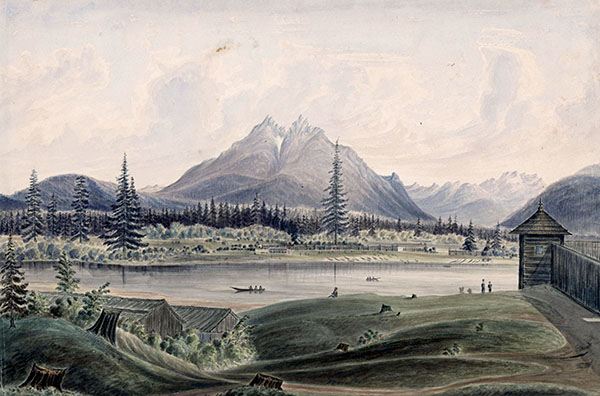
Caption: Landscape around Fort Langley, 1858.


The Hudson’s Bay Company (HBC) built Fort Langley 30 kilometres up the Fraser River, where Derby Ranch is today. The company tried to convince the Stó:lō people to trap furs, but the Stó:lō chose to keep their traditional salmon trade. Because of this, Fort Langley became mainly a salmon trading post.
(Image 102278830 courtesy of U.S. National Archives)
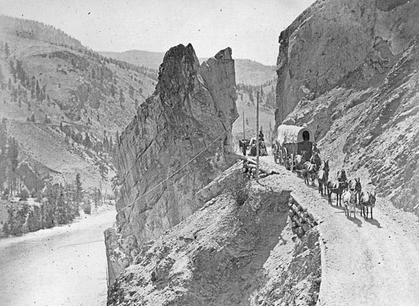
Caption: Wagons on the Cariboo Road near Yale, circa 1870s.
More than 30,000 miners came to Stó:lō Temexw (Stó:lō territory) looking for gold. Tensions grew between the Stó:lō and the newcomers. Small acts of violence turned into organized attacks by American soldiers against the Stó:lō people. Fighting broke out in the Fraser Canyon. When fall and winter came, hundreds of miners became sick with malnutrition and scurvy, and the Stó:lō helped them by giving them food.
(Image C-008077 courtesy of Library and Archives Canada)
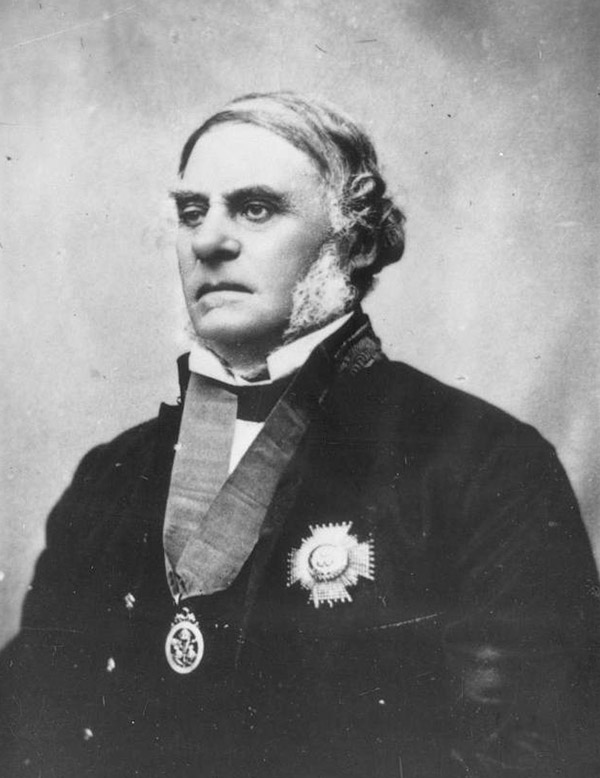
Caption: Governor James Douglas, 1864.
So many American miners came to the area looking for gold that the British government decided to make British Columbia a crown colony. James Douglas, Chief Factor of the Hudson’s Bay Company, became the first Governor.
(Image A-01229 courtesy of BC Archives)
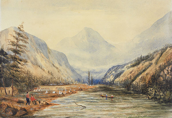
Caption: British Marines camp in the Fraser Canyon, 1859.
More than 3/4 of the gold miners who came for the Gold Rush leave Stó:lō Temexw. They left behind a legacy of disease, alcohol use and violence.
(Image 1989-171-29 courtesy of Library and Archives Canada)
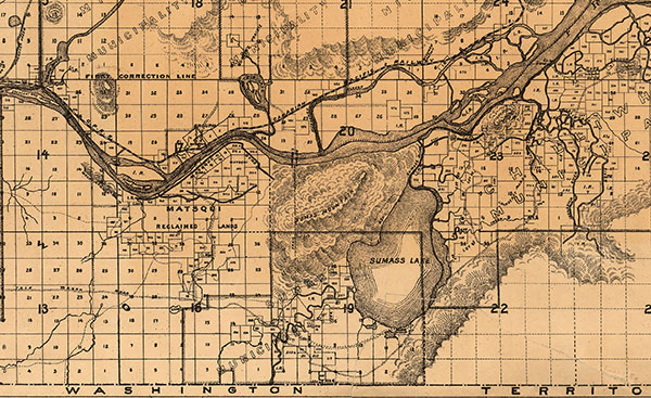
Caption: Map of the central Fraser Valley showing the grid used by the pre-emption system, 1892.
At this time, pre-emption was the way for people to claim land in B.C. If someone wanted ownership over a parcel of Crown land, it could be granted to them if they “improved” it by farming or building businesses. This system started in 1859 and became official in 1870.
(Image taken from MAP 446 courtesy of City of Vancouver Archives)
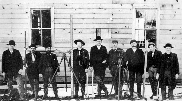
Caption: Sumas Prairie Surveyors, 1893.
Governor James Douglas led the Stó:lō people to believe that treaties would be signed to protect their lands. At the same time, settlers started arriving from Britain. Douglas had promised them good, cheap farmland in the Fraser Valley. The settlers chose the land they wanted and began building homes and clearing fields.
(Image D-01074 courtesy of BC Archives)
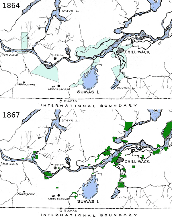
Caption: Map showing the reduction in reserves from 1864 to 1867.
Joseph Trutch, the Commissioner of Lands and Works, refused to recognize the original reserves created between Governor James Douglas and Stó:lō leaders. He denied the existence of Aboriginal Title, and had the reserves resurveyed. The boundaries were reduced by 91 percent without the consent of the Stó:lō people.
(Image taken from Seelkee, CC BY-SA 4.0, via Wikimedia Commons)
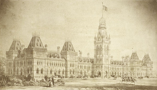
Caption: Canadian Parliament buildings circa 1870.


The Canadian Government wanted more settlers in the west to stop the United States from expanding north. They created the Immigration Act, opening offices in the United Kingdom and promising safe travel to people who wanted to move to Canada. Immigrants from Europe were preferred, but people of all backgrounds could come.
(Image Acc. No. 1970-190-4 courtesy of Library and Archives Canada)
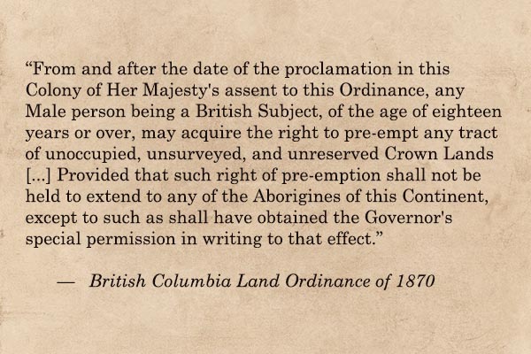
The British Columbia colonial government passed a law that stopped Indigenous people from pre-empting land without special permission. It also prevented them from buying land from settlers. Indigenous families were given much less land per family than settler families received.
(Quote taken from the BC Land Ordinance of 1870)
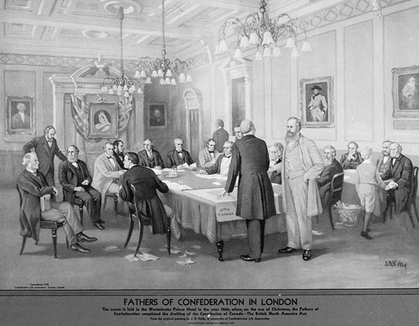
Caption: Meeting of the Fathers of Confederation in London, drawn in 1935.
The crown colonies of Vancouver Island and British Columbia combined and became the 6th province of Canada, with Victoria as the capital city. The federal government took over Britain's commitments to Indigenous peoples.
(Image D-05642 courtesy of BC Archives)
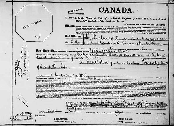
Caption: Western Land Grant in the Name of John Maclure, 1889.

In 1872, the Dominion Lands Act launched the Dominion Lands Survey, a massive project which helped map out the western provinces. It allowed male settlers over the age of 21 to claim 65 hectares of land for $10. This encouraged more European settlers to move west.
(Image courtesy of Library and Archives Canada)
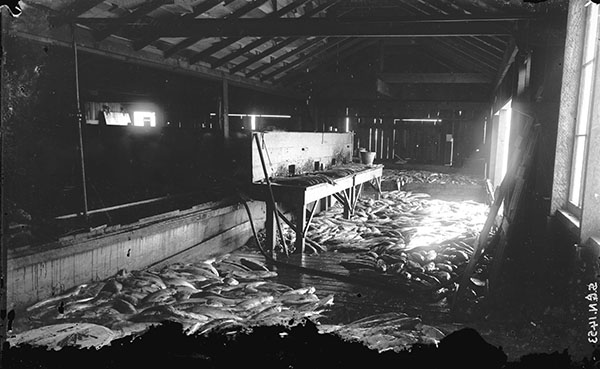
Caption: Interior of a Salmon Cannery, 1890s.
Starting in the 1880s, settlers began opening canneries on the Fraser River. These canneries caught and packed fish to be sold around the world. Many Stó:lō families found work at the canneries, with men doing the fishing and women and older children processing the salmon. Japanese and Chinese labourers were also employed to process fish at the canneries. Work was segregated by race and supervised by white management.
(Image SGN 1453 courtesy of City of Vancouver Archives)
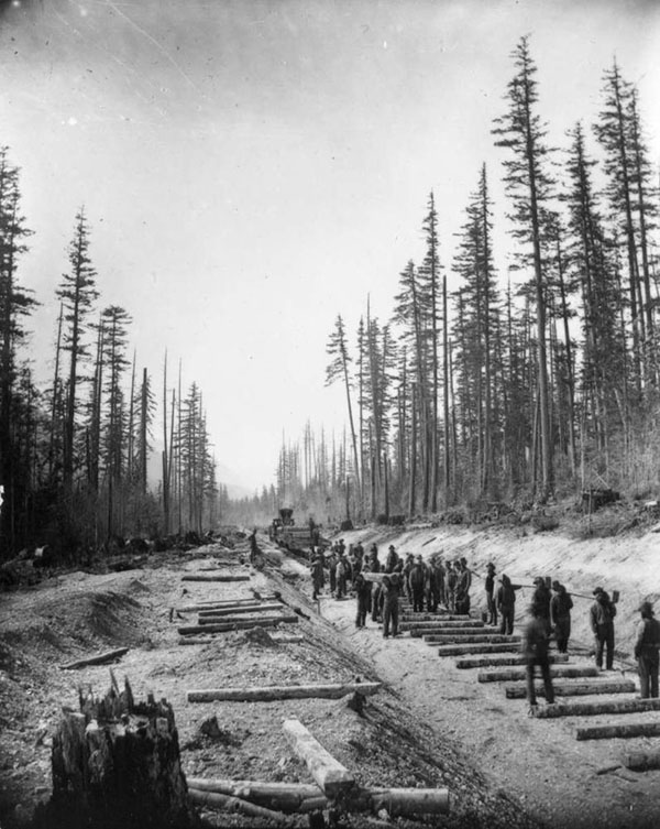
Caption: Men laying railway ties through the Fraser Valley, circa 1881–1883.
The Canadian Pacific Railway (CPR) began running through the Fraser Valley. Travel became much easier, and many European settlers moved into Stó:lō Temexw. Many of the Chinese immigrants who had helped build it moved to cities and towns to find work. Some settled in growing communities along the railway. Many opened restaurants, stores, or laundry businesses, while others became farmers. Employers started hiring Chinese workers for low pay in jobs that Stó:lō people used to do. This was unfair because it took advantage of Chinese workers and lowered wages for Stó:lō workers.
(Image A-07021 courtesy of BC Archives)

Caption: Mission as seen from the Matsqui side of the Fraser River, 1909.
After severe flooding in 1882 showed that the river dykes were not strong enough, the Matsqui Lands Company hired hundreds of Chinese immigrants to rebuild and strengthen the flood protection system. Many of these workers had recently arrived after helping build the newly completed Canadian Pacific Railway (CPR).
(Image B-07889 courtesy of BC Archives)
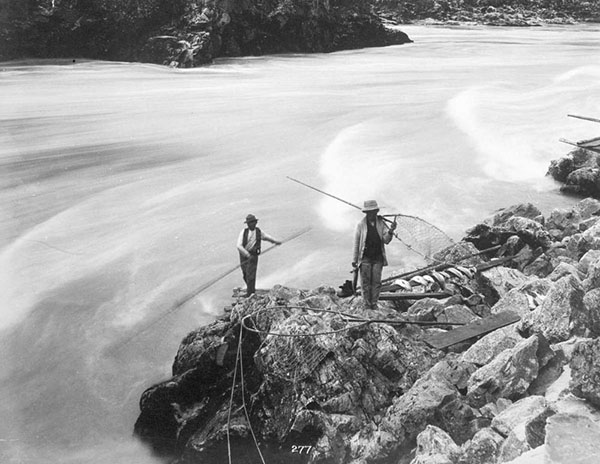
Caption: Stó:lō fishers catch salmon with nets, circa 1880s.
Because commercial overfishing was destroying salmon runs, the government banned the sale of fish caught in non-tidal waters without a license. Stó:lō fishers were not given these licenses, which meant they could not legally run their own commercial fishing businesses.
(Image A-06077 courtesy of BC Archives)
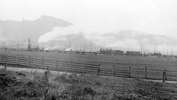
Caption: Train travels through Matsqui Prairie, circa 1912.
In 1889, an additional Canadian Pacific Railway line from Mission to the U.S. border was built. John Cunningham Maclure, a former Royal Engineer, pre-empted the land that would become downtown Abbotsford because he knew it was the best spot to build the railway. The station built there was named “Abbotsford” after Harry Abbot, a CPR superintendent.
(Image E-00487 courtesy of BC Archives)
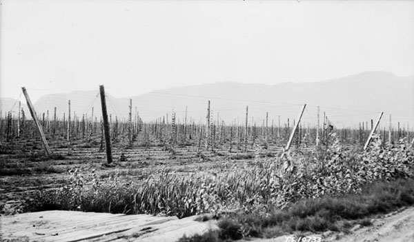
Caption: Hop field on Sumas Prairie, 1926.
Farmers in the Fraser Valley began growing hops, which provided seasonal work for Stó:lō workers. Both white and Stó:lō workers were hired to pick hops, but groups worked on different fields and didn’t mix very much. All pickers were paid the same, no matter what race, age, or gender they were. Hops-picking continued to be important to the Stó:lō economy until machines replaced human workers in the 1950s.
(Image PA-020110 courtesy of Library and Archives Canada)
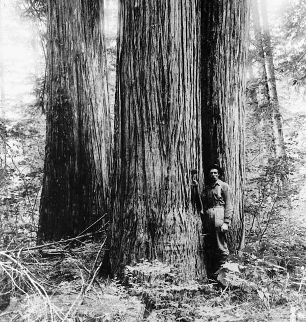
Caption: Red cedar in the Fraser Valley.
A small lumber mill opened on Railway Street in what is now downtown Abbotsford. In 1903 it became the Abbotsford Lumber Company.
(Image PA-040962 courtesy of Library and Archives Canada)
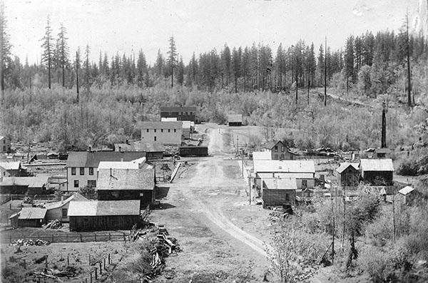
Caption: Village of Abbotsford circa 1905.
On July 9, 1891, the townsite plan for the Village of Abbotsford was officially filed. Abbotsford was one of many small villages—like Matsqui, Sumas, and Mt. Lehman—that later joined to form the city we know today.
(Image Out P754 courtesy of City of Vancouver Archives)
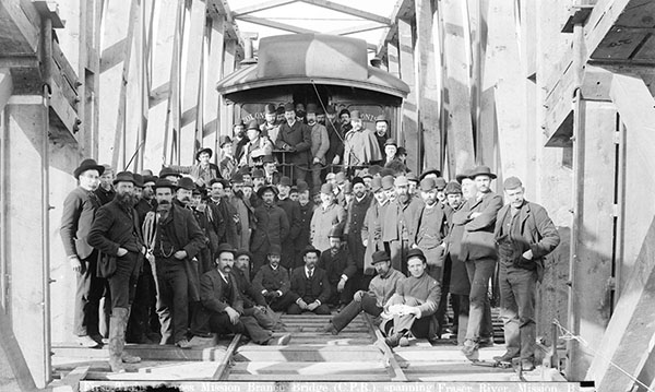
Caption: First train to cross the Mission Bridge in 1891.
In 1891 the Mission Railway Bridge opened between Mission and Matsqui. This was only the second bridge over the Fraser River and the only railway connection to the US at the time. Because travel was easier, Matsqui Prairie became more attractive place for European settlers to live.
(Image Out P45 courtesy of City of Vancouver Archives)
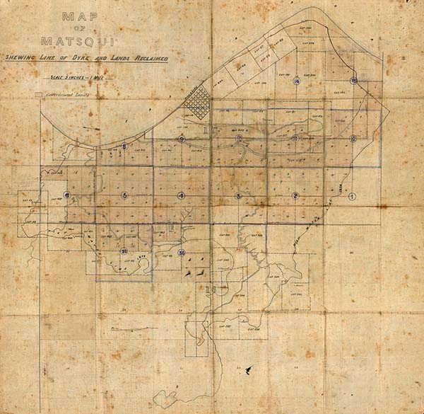
Caption: Map of the Matsqui Dykes along the Fraser River.
As settlers moved to Stó:lō Temexw, they wanted to shape the land to suit their needs. Matsqui Prairie was a desirable place to settle, but it had a problem: despite previous efforts, it continued to flood every year. Alexander Cruikshank was hired by the Matsqui Lands Company. He began recruiting Scandinavian families to help rebuild the dykes needed to make the land farmable.
(Map courtesy of Library and Archives Canada)
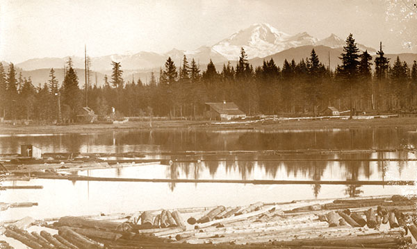
Caption: Early mill on Mill Lake with Mt. Baker in the background, circa 1901–1905.
The Abbotsford Lumber Company was sold to a group of businessmen, including brothers Richard Arthur and Joseph Ogle Trethewey. The mill moved from Railway Street to a much bigger site at Abbotsford Lake, now called Mill Lake.
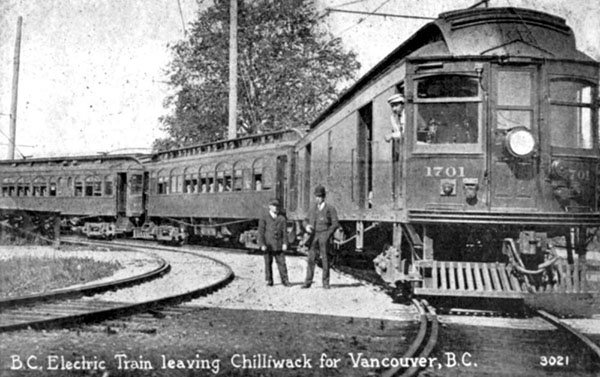
Caption: BCER Train on the Chilliwack-Vancouver line, 1910s.
Many new railways were built in Abbotsford, such as the Great Northern Railway, the Canadian National Railway, and the B.C. Electric Railway. These railways helped the lumber and dairy industries grow because they could now ship products quickly to cities like Vancouver. The Mill Lake lumber mill became one of the area’s most important businesses.
(Image E-00487 courtesy of BC Archives)
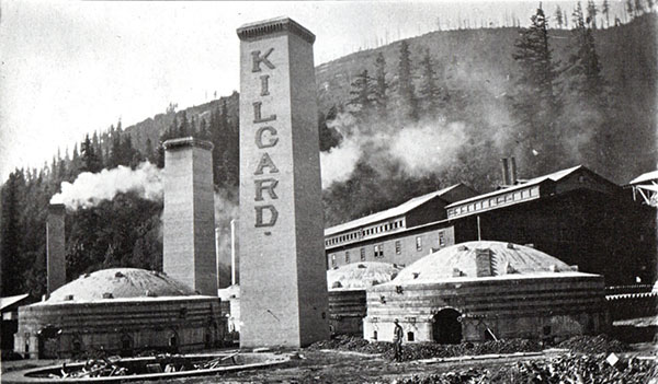
Caption: Kilgard brick factory circa 1930.
In 1909 Charles Maclure left the Clayburn Company after a disagreement and started the Kilgard Fireclay Company on Sumas Mountain. Clayburn bought Kilgard in 1918, and by 1920 they had updated the factory and moved their operations there.
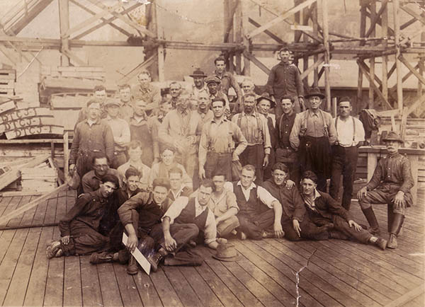
Caption: Millworkers from the Abbotsford Lumber, Mining, & Development Company, circa 1920s.
The lumber mill on Mill Lake upgraded by adding new machines. By this time about 150 workers of South Asian, Japanese, Chinese, and European backgrounds worked at the mill.
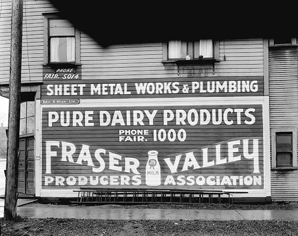
Caption: Fraser Valley Milk Producers Association advertisement, circa 1926.
In 1913, dairy farmers in the Fraser Valley created the Fraser Valley Milk Producers Association (FVMA). When it began operating in 1917, the co-op helped farmers collect and transport milk to markets and processing plants. This made it easier for farms to focus on dairy. The FVMA’s legacy continues today, including through companies like Dairyland.
(Image CVA 99-2283 courtesy of City of Vancouver Archives)
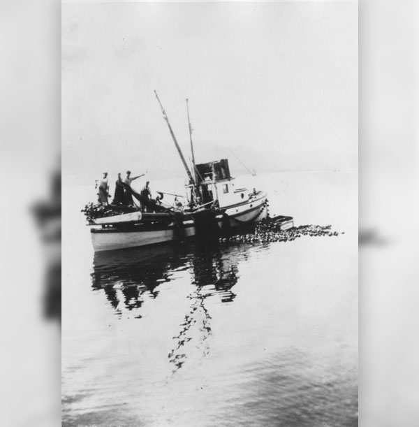
Caption: Japanese Canadian fishermen work on a fishing trawler.
After many years of low salmon returns, the Government banned all fishing on the Fraser River. Many Stó:lō people had to get other work picking berries, fruit, and other cash crops in Mission.
(Image 2001.04.138 courtesy of the Nikkei National Museum & Cultural Centre)
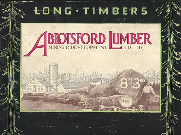
Caption: Advertisement for the Abbotsford Lumber Mining & Development Company, circa 1919 to 1928.
The lumber mill on Mill Lake expanded, and business was strong. In 1924, the mill closed for six weeks to upgrade its machines so it could process even more lumber. That year was a record year, with 275 workers and millions of feet of lumber produced.
(Image 85.41.1099 from Heritage Abbotsford Society)
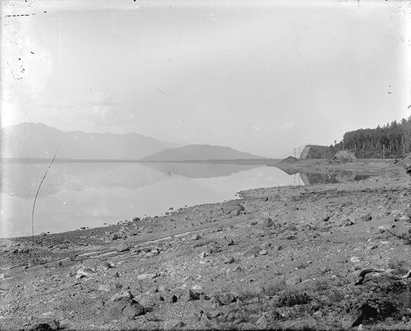
Caption: Sumas lake before it was drained, circa 1913.
In 1922, the provincial government formally decided to drain Sumas Lake, giving the contract to the Marsh Construction Company. By 1926 the work was completed, allowing farmers to settle the new Sumas prairie. The loss of the lake was devastating to the Semá:th people, whose original reserve was largely the lake itself. It was a source of food and a way of life, and it was a habitat for many birds, animals, and fish. The Stó:lō people were not consulted on the project, and the Semá:th were not compensated.
(Image LGN 1144 courtesy of City of Vancouver Archives)
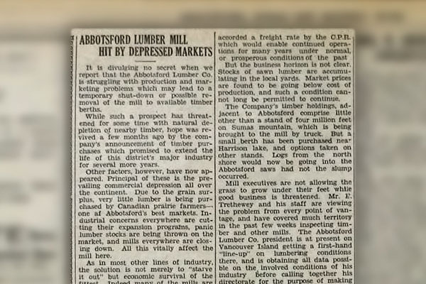
Caption: Article about the Abbotsford Lumber Company from the ASM News, circa 1930.
By 1928, the Abbotsford Lumber Company was in decline. Most of the nearby trees had already been cut, and the Great Depression made lumber less in demand. Because of pressure from locals and fewer jobs, the company fired 40–50 workers who were of South Asian, Chinese, and Japanese backgrounds—a racist layoff meant to keep jobs for white European workers. By the mid-1930s, the Abbotsford mill closed, logging stopped, and the company switched to selling products in stores instead.
(Image courtesy of the Abbotsford, Sumas and Matsqui News Archive)
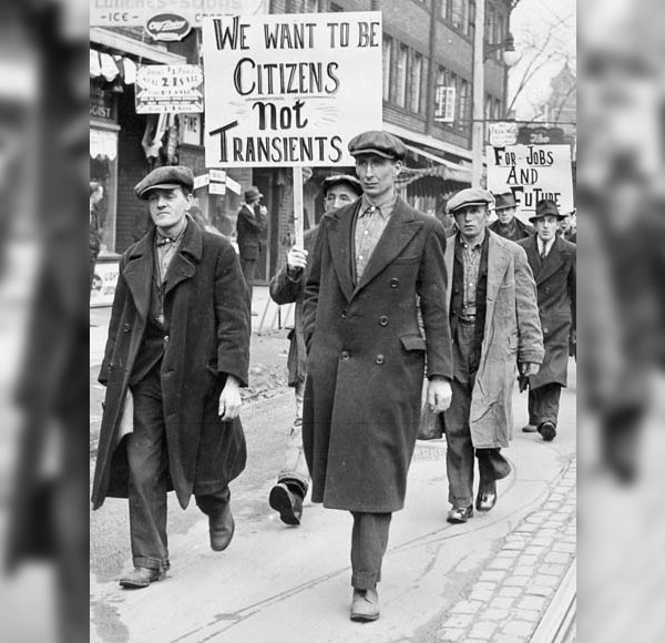
Caption: Out of work men protest during the Great Depression.
During the Great Depression, the Fraser Valley was protected from the worst effects of the Dust Bowl because of its climate. However, the collapse of the lumber industry and rising unemployment caused anxiety among British settlers. Many felt threatened by new migrants who they believed would compete for jobs and land.
(Image C-029397 courtesy of Library and Archives Canada)
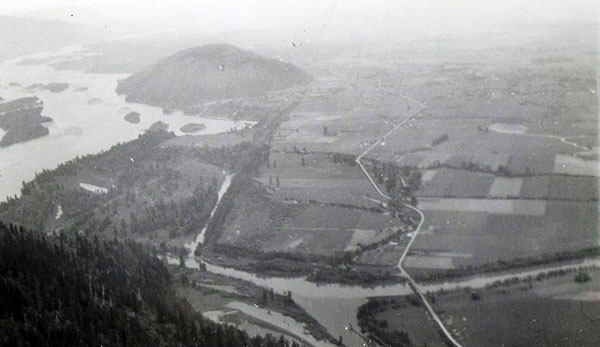
Caption: Aerial view from Sumas Mountain showing the Interprovincial highway running east to west over the Vedder Canal, circa 1940s.
In 1931, the first part of the Trans-Canada Highway in the Fraser Valley opened on Sumas Prairie. By 1941, the route from Clearbrook to Vancouver was complete. Trucking companies—mostly owned by white settlers at first—began moving goods by road. This made the railways less important to the local economy.
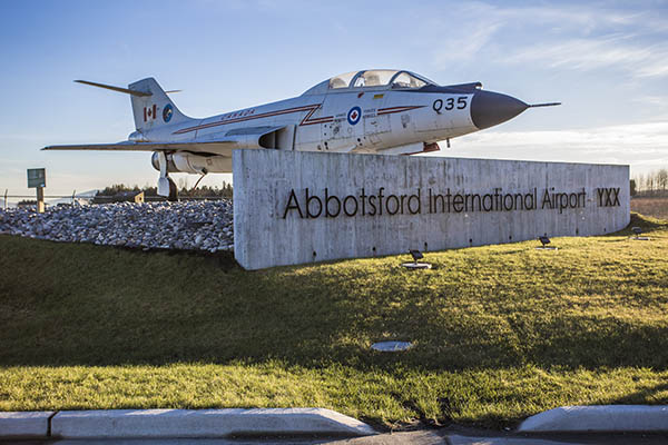
Caption: Entrance to the Abbotsford International Airport.
During World War II, an airport was built in Abbotsford to help defend the west coast. It opened on July 14, 1943, and became Canada’s biggest military airport, with more than forty buildings. The Royal Canadian Air Force Station closed in 1945, and the airport became civilian-run in 1958. In 1997, the City of Abbotsford bought it from the federal government, and it still operates today as Abbotsford International Airport.
(Image by YXXOps, CC BY-SA 4.0, via Wikimedia Commons)
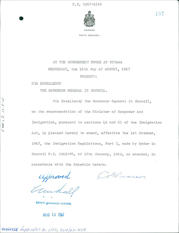
Caption: Order in Council amending immigration policy, 1967.

In 1962, Canada ended its system that set limits based on a person’s country of origin. In 1967, a new point system was created to decide who could immigrate, attempting to make Canada’s immigration rules fairer and less racist. However, the points system gave preference to workers with skills and education, instead of farmers and labourers who came from less privileged backgrounds.
("Immigration Act, Immigration Regulations, Part 1, Amended" courtesy of Library and Archives Canada via the Canadian Museum of Immigration at Pier 21)